You take a screenshot of an aerial map to check whether a new footbridge is in place on a park trail. The file on your desktop is dated today, and the corner of the map says “© 2026”. Neither date tells you when the camera actually flew over the park; both can be completely accurate while the imagery itself is three winters old.
When you combine third-party images, maps, or documents into a project, it’s easy to treat whichever date is easiest to see as the date of the facts in the picture. In practice, at least four different dates can be attached to the same image, and they answer different questions.
| Date type | What it records | What it does not record |
|---|---|---|
| Acquisition date | When the photograph, scan, or measurement was captured | When the publisher released it, or whether anything changed afterward |
| Publication date | When a dataset, map layer, or document was released or updated | When the underlying imagery was collected |
| Capture or screenshot date | When you saved or exported the copy you are holding | When the source was created or last refreshed |
| Copyright date | When the provider asserted rights over the map or composite product | When any individual tile or feature was photographed |
A copyright notice on a web map is usually the most misleading of the four. Map providers update their copyright year annually across the entire service, even when the aerial tile for a particular county hasn’t been updated in years. A file’s modified timestamp or embedded Exchangeable Image File Format (EXIF) metadata is only as useful as the step that wrote it: saving a screenshot records the moment you pressed the key, not the moment the scene existed.
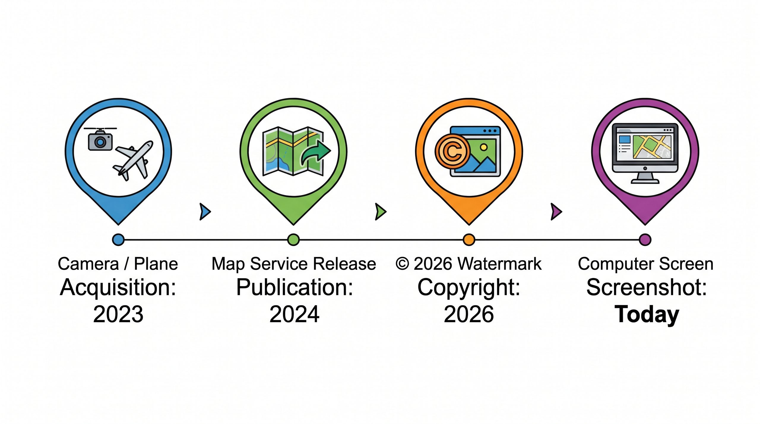
That distinction matters most when two sources disagree. For example, a field volunteer reports that a trail was rerouted last month, but the satellite view you saved this morning still shows the old path. Older imagery can’t disprove a recent change; it only shows what was there on the acquisition date, if you even know what that date is. If you don’t know when the image was acquired, treating it as current evidence turns a missing fact into a false contradiction.
The fix is to record provenance alongside the file instead of relying on whatever date happens to be printed on the corner. For each saved image or layer, note four things: where it came from, the acquisition date (or “unknown” if the source doesn’t state it), the date you captured or downloaded it, and what question you saved it to answer. Writing “unknown” feels less tidy than copying the year from the watermark, but it keeps a later reviewer from building a decision on a guess.
Next time you save a map, chart, or screenshot as evidence, separate the date you grabbed the image from the date the underlying observation was made; if the source won’t tell you when the observation happened, record that gap explicitly.
—jhunterj